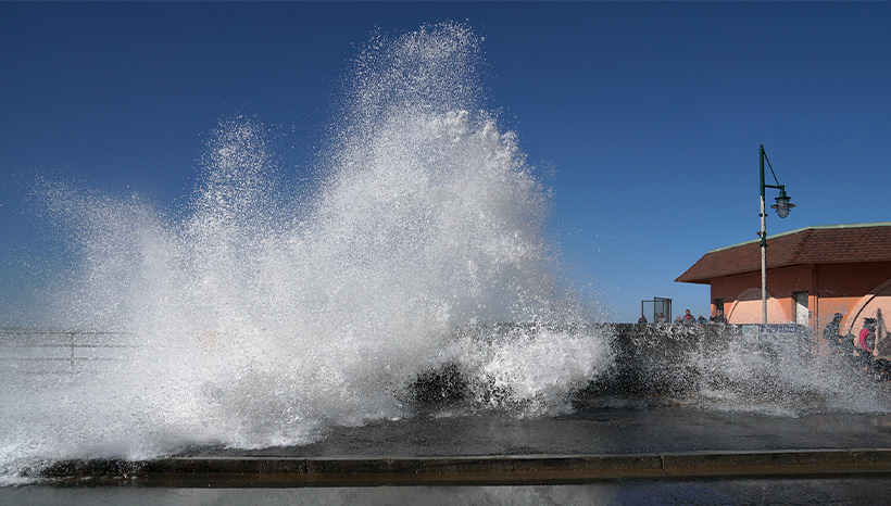
Dramatic surf crashing against the rocks. Monster waves looming over surfers as they ride their boards. The power of the ocean is on full display every day of the year on the California coast, and never more so than during the season of king tides.
King tides are exceptionally high tides that typically occur during a new or full moon and when the earth is closest to the moon. California’s biggest, most dramatic king tides typically occur during wintertime, when the sun and the moon line up and their combined gravitational pull creates both the highest and the lowest tides of the year. This winter, the biggest king tides are expected to hit the Bay Area on January 11-12, 2024 and February 9, 2024.
King tide events are interesting as a natural phenomenon, and also because they show us which areas will eventually start to flood more often, or even end up permanently underwater, due to sea level rise caused by climate change. The temporarily high ocean levels caused by king tides gives us a glimpse of the future, so we should pay attention to what they are telling us.
The California Coastal Commission’s King Tides Photo Gallery shows what king tide watchers have documented over the years – from flooded roads and bridges to waves breaking over boardwalks. These images bring the reality of sea level rise home in a way that graphs and numbers rarely do.
Flooding from king tides even occurs inland, due not to waves overtopping levees but because of how our storm drain system works. I took this video on a dry, sunny day in the Inner Harbor area of Redwood City during king tides in December 2018. On that date, there had been no recent rain events – the giant pool in the middle of this street came entirely from the water bubbling up out of the storm drain like a fountain. In other words, here we see the storm drain system working backwards – flooding the streets instead of draining them.
The California King Tides Project map shows where users have reported impacts from high tide levels around the Bay Area over the past few years.
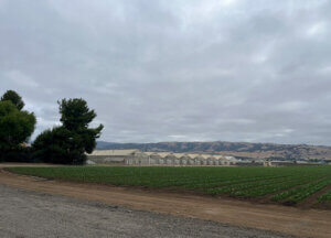
As glaciers melt and sea levels rise due to climate change, San Francisco is predicted to see sea levels rise from one to three feet by 2050, and by as much as seven feet or more by the year 2100. Local governments have already begun planning for how to adapt to rising sea levels, and a state law passed this year mandates that all coastal cities, including those on the Bayshore, must develop strategies for how to respond to the threat of sea level rise. It won’t be easy or cheap – a recent study found that protecting our communities will cost $110 billion by 2050. But the same study found that the cost of not taking action is $230 billion – nearly twice as much.
Ultimately, we need to plan for a future that looks very different from today. Even our best efforts at adaptation may not succeed in preventing vulnerable communities from constant flooding, or coastal bluffs from collapsing into the ocean. When areas become simply unlivable, “managed retreat” – moving homes and businesses away from vulnerable areas – becomes the only option. This is a controversial topic, but the fact is that we can have either managed retreat or unmanaged retreat. Planning ahead is both the smart option and the one that is most likely to protect at-risk communities.
Learn More and Share Photos or Videos
Interested in learning more about king tides? Want to share photos or videos of king tides in your neighborhood? The California Coastal Commission’s website provides information about king tides and their impact, and provides a way to share your photos and videos through its Snap the Shore, See the Future web page. Please share your photos with Green Foothills too. We may post them on our Facebook or Instagram or in a future newsletter.
Please keep in mind these precautions from the California Coastal Commission when taking photos of king tides: “The most important thing to remember is to be safe! Take extra precautions when you walk on slippery areas or near big waves, and always be conscious of your surroundings and the weather conditions. Don’t turn your back on the ocean! Please be aware that shore birds may be taking refuge in areas above the tide line – don’t flush them out in the process of getting your shot.”