This is an updated version of an article that was originally published on May 24, 2022.
At Green Foothills, we focus some of our strongest advocacy efforts on the habitat linkages that are the key to protecting local wildlife. Only a few of these critical linkages are left in the Bay Area — and they’re increasingly at risk from development. Because Green Foothills focuses on San Mateo, Santa Clara, and San Benito Counties, we’re especially focused on preserving habitat linkages that allow wildlife to migrate in and out of the Santa Cruz Mountains.
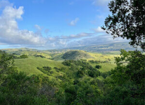
The Santa Cruz Mountains: A Fragmented Landscape
The Santa Cruz Mountains form the green spine of the Peninsula, an oasis of natural habitat running down through San Mateo and Santa Clara Counties. These hills are home to redwood and oak forests, grasslands and chaparral, creeks, and streams. But the Santa Cruz Mountains are also a fragmented landscape – meaning that even though there are large blocks of protected habitat, these blocks are often separated by roads, patches of development, and other barriers to wildlife movement. Furthermore, this area is at risk of becoming cut off from other large habitat areas in California. If that happens, inbreeding and inability to disperse to find food and mates could spell disaster for many wildlife populations, with cascading effects on the entire local ecosystem. Climate change, bringing changes in habitat, increased fire risk, and water scarcity, makes it even more imperative to allow species to move out of their usual ranges.
Experts agree that the only remaining linkages between the Santa Cruz Mountains and the rest of the state are through Coyote Valley (just south of San Jose) and Juristac (southwest of Gilroy). In every other location, wildlife movement is effectively blocked by the urban development of Silicon Valley. This is one reason why these two landscapes are the focus of major advocacy campaigns at Green Foothills: they are lifelines for animals.
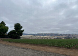
Coyote Valley — A Difficult Path
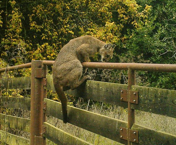
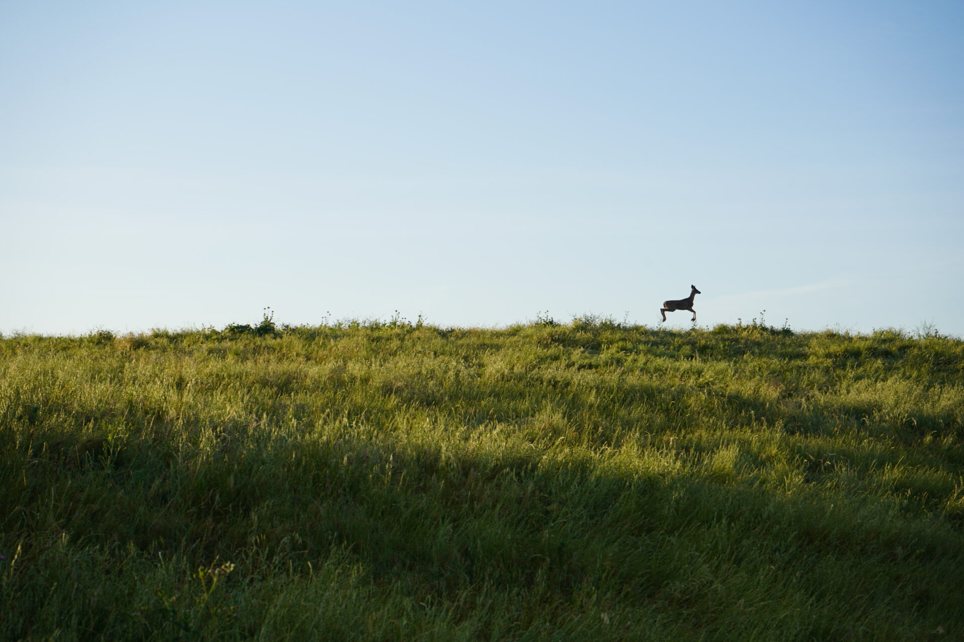
Coyote Valley is a critical linkage connecting the Santa Cruz Mountains to the Diablo Range. Wildlife tracking studies have repeatedly found numerous animals—mountain lions, coyotes, bobcats, deer, badgers, gray foxes, and others—in and around the valley floor. Animals have also been documented crossing the two major barriers of Highway 101 and Monterey Road via culverts and underpasses. However, animals traveling through Coyote Valley must run a gauntlet of dangers, including speeding vehicles and ingestion of rodenticide. Monterey Road in particular is a serious barrier, with only one somewhat functional undercrossing – a culvert that can be blocked by debris or high water. Nighttime lights, noise, and human activity also hamper wildlife passage and habitat in much of Coyote Valley. As a result, although Coyote Valley functions as a wildlife linkage, it is a highly impacted one and forms a very tenuous lifeline for the animals that use it.
At the core of this issue is the common assumption that all that animals need for survival is a “wildlife corridor”—in other words, people often think that as long as it is technically possible for an animal to move from one area to another, habitat connectivity has been achieved. This is a fundamental misconception about the nature of wildlife movement. Most animals instinctively avoid human activity and will travel for hours or even days to go around a developed area in order to avoid vehicles and other perceived dangers. Without intentional restoration, the journey across “wildlife corridors” like Coyote Valley with limited human interaction is stressful for animals and can affect their health.
What is needed for true connectivity are habitat linkages—broad swaths of fully functional habitat that allow normal ecological processes to occur. Large mammals such as coyotes and bobcats need smaller prey animals to survive, and those smaller animals need the appropriate vegetation for foraging and breeding. A functioning linkage needs a functioning ecosystem. And it needs to be much wider than the conventional image of a “wildlife corridor.” Studies have concluded that a linkage at least 1.2 miles wide is necessary for Coyote Valley to provide both “live-in” and “move-through” habitat.
The Goal: A True Habitat Linkage in Coyote Valley
For decades, Green Foothills has been fighting to protect Coyote Valley’s fragile wildlife linkage from the threat of development. Coyote Valley’s fields and farmland were once intended for massive tech campus development proposals from companies like Apple, IBM and Cisco. It took strong opposition from Green Foothills and other environmental organizations, local residents, and community leaders to avert these threats and maintain Coyote Valley as open space. Finally, in 2019 nearly 1,000 acres of wetlands, farmland, and habitat were permanently protected through a joint effort by the Peninsula Open Space Trust (POST), the Santa Clara Valley Open Space Authority (OSA), and the City of San Jose (using funding approved by San Jose voters in 2018).
Green Foothills then led the Protect Coyote Valley coalition in advocating for San Jose to create a new vision for Coyote Valley – a vision of protected open space, wildlife habitat, restored creeks and floodplains, and fertile farmland instead of tech campuses, warehouses and distribution centers. In 2021, the San Jose City Council voted to change the land use designation for North Coyote Valley from industrial to agriculture and open space, effectively declaring that the city no longer intended to develop in Coyote Valley.
Nevertheless, landowners continue to push for new development in this critical wildlife linkage. Coyote Valley still needs the efforts of Green Foothills, our Protect Coyote Valley partners, POST and OSA, and everyone who wants to protect the ability of wildlife to not just survive but thrive in our region. To learn more about current development threats in Coyote Valley and how you can help to protect this landscape, sign up to receive Green Foothills’ e-newsletter.
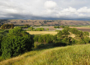
Juristac — Gateway to the South
At the southern end of the Santa Cruz Mountain range lies a landscape with an incredible variety of habitats and geological features, from rolling hills to nearly pristine sycamore riparian woodlands to rare natural tar seeps. This is Juristac, the sacred heart of the ancestral territory of the Amah Mutsun Tribal Band. For thousands of years, the Mutsun lived and held sacred ceremonies here, in the hills above the confluence of the San Benito and Pajaro Rivers.
Although Juristac provides habitat for many at-risk species, including mountain lion, American badger, California red-legged frog, California tiger salamander, and Golden Eagle, the critical significance of Juristac for habitat connectivity lies in its location. The Santa Cruz Mountains come to an end at Juristac, and in order for species here to travel across the Pajaro River valley to the Diablo Range to the east, or across the Chittenden Gap to the Gabilan Range to the south, they must pass through Juristac.

But Juristac is threatened by a proposed open-pit sand and gravel mine that would severely impact these linkages. The Sargent Ranch Quarry would excavate three pits hundreds of feet deep in the hillsides of Juristac, literally scooping out these hills and leaving behind giant cavities. These pits, together with the new roads for heavy machinery, a conveyor belt more than a mile long to move the sand and gravel, and a processing plant the size of 10 football fields, would form a major barrier to wildlife movement. Aside from the physical destruction of the landscape, the noise and activity involved in an open-pit mining operation would deter many animals from venturing near the site. Further, the giant processing plant, where heavy industrial activity such as rock crushing would occur, would be immediately adjacent to the most important wildlife undercrossing beneath Highway 101, and the haul trucks loaded with sand and gravel would travel through that undercrossing.
The Goal: Protecting Juristac
Green Foothills is partnering with and supporting the Amah Mutsun Tribal Band in the fight to protect Juristac from this destructive open-pit mine. The tribe is leading the Protect Juristac effort, a coalition of tribal allies, environmental organizations, social justice groups, faith-based organizations, students, and others who are fighting to protect this sacred Indigenous landscape and critical wildlife linkage.
The Sargent Ranch mining proposal is currently undergoing environmental review by Santa Clara County under the California Environmental Quality Act (CEQA). The Draft Environmental Impact Report (DEIR) conducted by the County found 14 separate significant and unavoidable impacts from the mine, including impacts to tribal cultural resources, wildlife movement, air quality, and aesthetics. These significant and unavoidable impacts will occur even with attempts at mitigation.
In particular, the DEIR found that there would be “permanent and irreversible alterations” to the Juristac Tribal Cultural Landscape, and that no reclamation activities could ever restore it to a condition that reflects its cultural significance. The DEIR also found that the mine, due to its location directly across a major wildlife corridor in and out of the Santa Cruz Mountains, would interfere substantially with wildlife movement, which could reduce genetic variability and make animal populations more vulnerable to local extinction.
When the DEIR was released by the County in 2022, public opposition to the mining operation was overwhelming. More than 10,000 comments and emails were submitted to the County in response to the DEIR. The majority of letters came from Santa Clara County voters, plus scientists, academics, and interested parties from across the region. Of those comments, the overwhelming majority – 99.99% of submissions – opposed the proposed mine and raised concerns and questions about the mine’s social and environmental impacts. Fewer than 10 comments, or 0.1% of all comments received, supported the project – and of those, several were from the quarry proponent.
Since then, public opposition to the mine has only increased. In response to requests from the Amah Mutsun Tribal Band, Green Foothills, and the rest of the Protect Juristac coalition, seven cities – Gilroy, Morgan Hill, Mountain View, Palo Alto, Santa Clara, Santa Cruz, and Sunnyvale, plus the county of Santa Cruz – have passed resolutions calling for the rejection of the Sargent Ranch mine and the permanent protection of Juristac. More than 25,000 people have already signed a petition in support of protecting Juristac, and over 100 current and former elected officials, community leaders, and nonprofit organizations have signed on to a Statement of Opposition to Sargent Ranch Quarry.
Santa Clara County is currently reviewing the over 10,000 DEIR comments in preparation for releasing the final EIR. According to the County’s best estimate, the Sargent Ranch Quarry project may come to a vote before the Planning Commission and Board of Supervisors by late 2025 or 2026.
To be notified when there is an opportunity to take action to protect Juristac, subscribe to Green Foothills’ e-newsletter.
Species Need Room to Move
Protecting open space is about more than just preventing development on parcels of land—it means meeting all the needs of the diverse species in our region, including the room to move. When we protect, enhance, and restore our local habitat linkages, we’re working to safeguard the biodiversity and richness of the Bay Area ecosystem and making this a place where wildlife truly thrives and communities live in balance and reciprocity with nature.
How You Can Help
To receive alerts when there’s an opportunity to speak up for protection of Coyote Valley, Juristac, and other key areas for wildlife, subscribe to our e-newsletter at greenfoothills.org/subscribe.
As a nonprofit, Green Foothills depends on charitable donations to support our work. Please make a contribution at greenfoothills.org/donate. Your gift of any amount helps.